DeSoto National Forest - Tuxachanie Trail & WW2 POW Camp
Saucier, MS, 39574 US / MS


Location Description
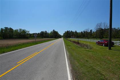
The first five miles of Tuxachanie Trail (between the trailhead on Highway 49 and the Airey Campground offer a variety of habitats, all offering wildflower viewing opportunities in season. The trail crosses a variety of wetland situations including sloughs, creeks, ponds, pitcher-plant bogs, and lowland swamps. Intermixed with these wet habitats are acres of dry, sandy longleaf pine woods. There is even a small beech-magnolia forest about a mile from the trailhead. This section of trail follows an old abandoned logging railroad built in the early 1900s by immigrants using hand tools and mule-drawn earthmovers. Visitors enter the trail through long rows of live oaks planted at the site in 1935. The trail is fairly flat and easy walking and includes several sections of elevated wooden footbridges. There is a short section of the trail that is shared by a horse trail. The trailhead can be reached from either U.S Highway 98 near Hattiesburg, Mississippi or I-10 near Gulfport, Mississippi. In both cases, take the U.S. Highway 49 exit and drive North from Gulfport (xx miles) or South from Hattiesburg (yy miles). The trailhead is located 2.5 miles north of Saucier, Mississippi, is on the east side of the highway, and well marked. Parking is available. Ownership and Management: U.S. Forest Service, National Forests in Mississippi, DeSoto Ranger District.
Location Category
- AGRICULTURE - [general]
- AGRICULTURE - Agri. Research Stations
- AGRICULTURE - Wildflowers
- GOVERNMENT - [general]
- LAKES / RIVERS - [general]
- LAKES / RIVERS - Lakes / Reservoirs
- LAKES / RIVERS - Ponds / Fishing Holes
- LAKES / RIVERS - Swamp / Marsh / Lagoon
- LANDSCAPES - [general]
- LANDSCAPES - Forests / Wilderness
- LANDSCAPES - Forests / Wilderness
- MILITARY - [general]
- MILITARY - Historic
- PARKS - [general]
- PARKS - Camping / Camp Grounds
- PARKS - Federal / National Parks
- PARKS - Historic Parks
- PARKS - Nature / Trails / Bike
- PARKS - Nature / Trails / Bike
- PARKS - Nature Preserves
- ROADS / HIGHWAYS - [general]
- ROADS / HIGHWAYS - Dirt Roads
- ROADS / HIGHWAYS - Rural / Country Roads
- ROADS / HIGHWAYS - Winding / Curvy